
Maps Department - History of the collection
Researches on origins of cartographical collections indicated that they are related to former City Library, former University Library, including Frankfurt (Oder) Viadrina and Wroclaw’s Leopoldinum, as well as libraries of nobles, courts, schools and other institutions. After Second World War dominating become Polonica and Silesiaca. Profile of gathered collection has been partially forced by their origins – many materials originated from Thomas Rehdiger library from Cologne from 16th century, that was later merged with former City Library.
Oldest original atlas (from medieval cartography materials, Library is only in possession of facsimiles editions), that is present in Old Prints Department, is Ptolemy's Geography from 1482, published in Ulm, woodcut edition, on parchment, in parchment binding with embossed super ex-librise of Thomas Rehdiger (first, copperplate edition from 1477, property of former University Library, has been lost during war). In Central Catalog of Cartographic Collections edited by Marian Łodyński Geography from 1482 is listed at first place. It is the oldest atlas in Poland. Besides our specimen, three others are in The Kórnik Library of the Polish Academy of Sciences, Jagiellonian Library in Cracow and in The Ossolinski National Institute in Wroclaw. In collections is also present Rome’s edition of Ptolemy's Geography by Marc Beneventano from 1508, important because of Middle Europe map by Nicholas of Kues, on which territory of Poland has been compiled with cooperation of first Polish cartographer - Bernard Wapowski with additional information by Jan Długosz. It is very rare edition – besides our specimen there is only one more in Poland – in University Library in Toruń.
In the whole collection of atlases, leading role plays ones from 16th - 18th century, that are largest collection in the whole Poland, that was indicated in mention above Central Catalog. in statistical data. Most of this collection, due to its provenance, is present in Old Prints Department, but this materials were also processed in a way, that will reflect their cartographic value and have catalog cards in Maps Department’s catalogs.
Second distinguished collection is so called factice atlases, i.e. framed together sets of maps, planes and views, that were published separately but then were selected, sorted and bound together in most of cases by private collector, and that’s why, they sometimes holds really unique items. Most valuable among them is seven-volumed collection of father and son - Zacharias and Amadeus Machnizky (1000 maps, plans and sights), with most precious fifth volume that holds almost complete collection about Silesia region. Jointly, in all factice atlases are over 1900 registry items of maps, plans and town views.
Started in 70s of 20th century separated collection of topographical and other multi-charted maps, systematically supplement with antique purchases, including modern editions of such maps. Overall collection of old topographical maps counts over 4.500 sheets, with addition of 2.500 of sheets of Polish maps currently published in scales: 1:10.000, 1:50.000 and 1:100.000.
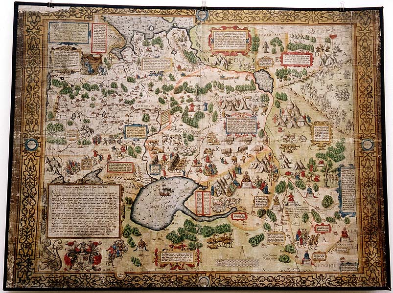
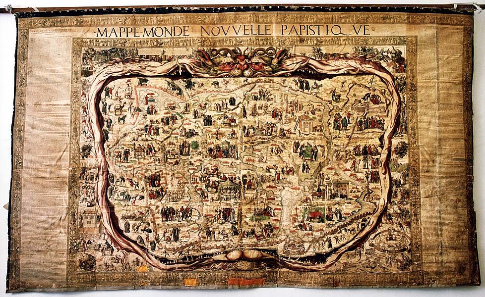
Although war damages, this collection still holds many surprises, that are uncovered during researches. During domestic and foreign symposiums in recent years, many rare and unique items were discovered, most of them hidden within mentioned above factice atlases, because their owners tried to gather most precious maps, plans and views of regions or territory, that were of their interest. And so, to rare specimens within Library’s collections, belongs, besides mentioned above two editions of Ptolemy's Geography handwritten atlas by Battista Agnese from circa 1540 (item held in Manuscripts Department), Anthony Jenkinson’s map of Russia, iscovered and purchased by Library in 1987, dated to be from 1562, and, from the same year, map of Prague created by two Prague printers - Jan Kozl and Michael Peterle. To unique publications should also be counted: first of four May’s editions of Abraham Ortelius’ Atlas from 1570 (item in Old Prints Department), first edition of Moravia map by Jana Amos Comensky from 1664, French allegoric world’s wall map from years 1566/67, created by Pierre Eskrich, second copy of woodcut map of Silesia by Martin Helwig from 1605 (first copy from l56l has been lost during Second World War) and next one from 1776 with supplemented Comment from 1564, maps of three Silesian duchies (duchy of Jawor, Legnica and Swidnica) by Fridericus Khünovius from second half of 17th century, two views of Karlovy Vary by Henricus Frater and Johann Schindler from years 1647 and 1652, plan of south excavations under Vienna city by Daniel Suttinger from 1683, view of Budy siege from 1686 by Martin Lerch and Johann Jakob Hofmann preformed on basis of drawing by Justus van der Nypoort, sectional plan of Paris by Michael Etienne Turgot and Louis Bretez from circa 1740, layout of Leipzig’s gardens by David Schatz and Paul Christian Zincke from 1705, Atlas of Polish countries by Jędrzej Słowaczyński from 1844, Poland’s statistical atlas by Stanisław Plater from 1827 and many others.List of this interesting items is long and will surely get longer with continuous researches into collection.
During Second World War, as part of operation to secure collections of former University and City Libraries, cartographic collections were relocated to Gruszowo in Swidnica district, Borowina Szprotawska in Szprotowa district and to Corpus Christi Church in Szprotawa. Many collections were engulfed in flames of war, and although lost, there are still worthy to mention, because they also creates history. And so, from former City and University Library, were lost: first copy of woodcut map by Martin Helwig from 1561, Gerard Mercator’s maps of: Europefrom 1554 and world from 1569, original of first plan of Wroclaw from 1562, created by father and son of the same names: Barthel Weiner as well as first Bologna’s edition of Ptolemy’ atlas from 1477, first edition of writing of Joannes Honter from 1530 and many more, about which we could read in pre-war publication, e.g. in article by V. Tooley, Maps in Italian Atlases of the Sixteenth Century being a comparative list of the Italian maps by Lafreri, Forlani, Duchetti, Bertelli and others, found in atlases. Imago Mundi III, 1970, s. 12-47 regarding precious collection of maps by Italian cartographers.
History of post-war collection is connected with history of Wroclaw University Library, created be merging of all listed above collections. Maps Department, originally named Cartographic Cabinet, has been created little later, than Library itself, in 1949, and in 1958 it has been relocated to Sand Island Library on Św. Jadwigi St.
Currently, WUL’s cartographic collections, due to their history and value, are one of most precious ones – not only in Poland, but also in the worldly scale.